
265 Moffett Blvd
BAA’s Mountain View office and organic garden from 1999 to 2001.
37.397183
-122.076358
View on Google Maps

504 Emerson St
The birthplace of BAA and the office of Earth Day 1990. Originally on the ground floor (#504), later in the basement (#504-A).
37.44433297015303
-122.1625686576489
View on Google Maps

715 Colorado Ave
BAA’s second home, in Midtown Palo Alto. BAA ran the building and sublet to numerous small businesses and nonprofits.
37.43347135384328
-122.12815818366083
View on Google Maps
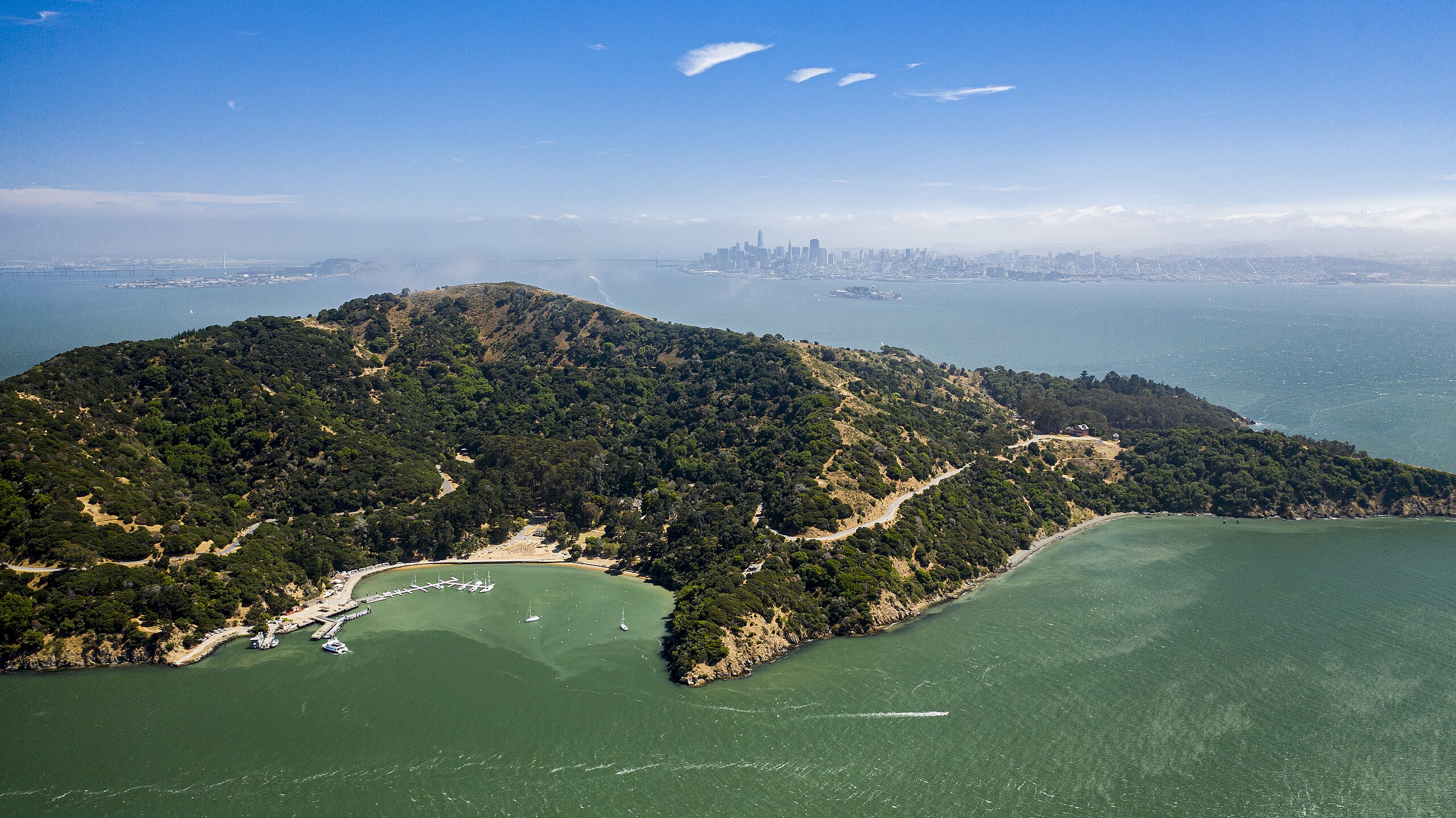
Angel Island
Angel Island’s primary environmental challenges in the 1990s were the management and removal of invasive, non-native vegetation (especially eucalyptus) and the issue of deer overpopulation. It is the largest natural island in San Francisco Bay and is now a state park.
37.86060153503602
-122.43113245104054
View on Google Maps

Arastradero Preserve
BAA staff and volunteers took on invasive species, habitat degradation, and loss of native oaks in a historic project stewarding the 609-acre Palo Alto park.
37.387307774200764
-122.1747985885573
View on Google Maps

Arctic National Wildlife Refuge
ANWR is a vital ecosystem supporting diverse wildlife, including polar bears, caribou, and migratory birds from six continents.
68.52791185416129
-143.65628840482356
View on Google Maps

Bair Island
Grassroots activists fought developers for decades, ultimately preserving Bair Island in 1997 as part of a national wildlife refuge.
37.5299362
-122.2221881
View on Google Maps

Butano Forest
Activists fought to preserve Butano’s redwoods during the 1990s timber wars, opposing increased logging efforts.
37.21296174853022
-122.30537488887002
View on Google Maps

California Coast
The CA coast was threatened in the 1990s by offshore oil drilling and logging. Activists fought back, leading to local ordinances and the Monterey Bay National Marine Sanctuary.
37.24464395188122
-122.45859101282656
View on Google Maps

Cargill Salt Marshes
Cargill’s salt ponds provide habitat for diverse wildlife but pose risks of toxic bittern spills, threatening Bay ecosystems.
37.51319717870761
-122.06952207118695
View on Google Maps

Clayoquot Sound
Endangered forest in British Columbia, about 5 hours west of Vancouver.
49.13553114568605
-125.89732063433448
View on Google Maps

Coyote Valley
In the late 1990s tech campuses and housing developments threatened Coyote Valley’s open space, wildlife habitat, and agricultural lands.
37.21709165099496
-121.721184127556
View on Google Maps
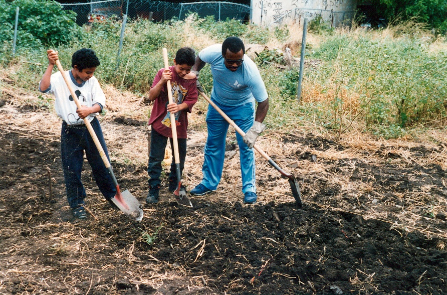
East Palo Alto Community Garden
EPA-HAS and BAA ran a thriving organic community garden where families could grow and sell their own food.
37.47050888778432
-122.13615324461293
View on Google Maps

Edgewood Park
Development threats, invasive species, habitat degradation, and endangered species decline, led to conservation efforts and a “Natural Preserve” designation in 1993.
37.47369161402502
-122.27867616157972
View on Google Maps

Foothills Park
Adjoining Arastradero Preserve, Foothills was site of Acterra’s Native Plants Nursery in 2001. Foothills has also hosted many BAA events.
37.36319723386549
-122.17206390900384
View on Google Maps

Gazos Mountain Camp
Gazos Mountain Camp hosts critical marbled murrelet habitat, coho salmon watershed, and old-growth redwoods, supporting endangered species conservation.
37.200429433815515
-122.29519781784096
View on Google Maps

Headwaters Forest
BAA members and activists from all over fought to save Headwaters from Maxxam’s threat, from 1990’s Redwood Summer until the US government purchased it in 1999.
40.632896275266425
-124.06516426258526
View on Google Maps

Hidden Villa
Hidden Villa in Los Altos Hills, is a nonprofit educational organic farm and wilderness preserve that teaches about the environment and social justice. Hidden Villa was a regular partner with BAA, particularly for events. Hidden Villa won a Business Environmental Award from Acterra in 2004.
37.352184781109926
-122.16012504816148
View on Google Maps

Humboldt County
Timber wars, habitat loss, endangered species decline, and watershed degradation threatened Humboldt County’s ecosystems throughout the 1990s
40.79058894269993
-124.0518863423927
View on Google Maps

Los Trancos Creek
Peninsula creek in the Stanford hills that runs into San Francisquito Creek.
37.41451487043194
-122.19174558340282
View on Google Maps

Midtown Palo Alto Community Garden
A small but impactful community organic garden operated by BAA from 1994 to 1999, just a short walk from BAA’s Colorado Ave office.
37.434501
-122.129593
View on Google Maps

Mitchell Park
BAA hosted many events at Mitchell Park over the years, including Earth Day festivals and fundraiser concerts.
37.42163491560971
-122.1149086607206
View on Google Maps

Moffett Field
Activist groups such as BAA raised concerns in the 1990s about groundwater and soil contaminated by VOCs, pesticides, PCBs, and heavy metals.
37.409576846035456
-122.0508018921514
View on Google Maps

Montara Mountain
Development threats, habitat fragmentation, erosion, invasive species, and endangered plant loss challenged Montara Mountain’s unique ecosystem.
37.53046860920537
-122.42701761341108
View on Google Maps
Ohlone Field
Despite its significance as Ohlone ancestral land and sensitive riparian habitat, Stanford University developed the open space at the edge of San Francisquito Creek.
37.43938907863893
-122.17905906635063
View on Google Maps

Palo Alto Baylands
The Baylands is critical habitat for migratory birds, endangered species, and wetland ecosystem resilience. BAA performed regular clean-ups here in the early 1990s.
37.45818135232296
-122.10646614777117
View on Google Maps

Peninsula Conservation Center
Home of the PCCF from 1993 to 2000 when it merged with BAA to become Acterra. The building is cooperatively run with numerous other nonprofit.
37.43094581670879
-122.1033747762415
View on Google Maps

Pigeon Point
In the 1990s Pigeon Point faced habitat degradation, invasive species, and development pressure threatening its coastal ecosystem and historic lighthouse.
37.18255146391223
-122.39406520754447
View on Google Maps
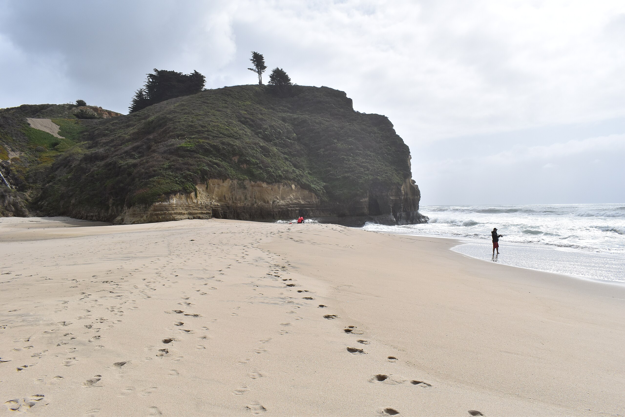
Pomponio State Beach
In the 1990s, San Pomponio Beach faced environmental challenges including sewage and chemical pollution, which led to beach closures and health advisories, and erosion caused by hindered sand replenishment.
37.30080473344407
-122.40670291987972
View on Google Maps

Potrero Commons
Activists fought to preserve open space on San Francisco’s Potrero Hill in the 1990s, opposing development plans for Portola Commons.
37.75519155311416
-122.39769842624095
View on Google Maps

San Antonio Shopping Center
BAA’s Eco-Store had a temporary home in this shopping center for a period in late 1993 and early 1994.
37.4036135160539
-122.10829003136286
View on Google Maps

San Bruno Mountain
San Bruno Mountain hosts rare plants and endangered butterflies, a biodiversity hotspot just south of urban San Francisco.
37.68887731470138
-122.43649374771199
View on Google Maps

San Francisco Bay
The body of water for which the region is named. Earth Day 2002 focused on issues revolving around SF Bay.
37.71136424629846
-122.31353973357149
View on Google Maps

San Francisco Estuary
The estuary encompasses the SF Bay and extends inland, featuring a salinity gradient and diverse ecosystems from saltwater to freshwater habitats.
37.69823168736122
-122.31358359470552
View on Google Maps

San Francisquito Creek
Steelhead trout, red-legged frogs, and native riparian plants thrive here. BAA volunteers cleaned the creek many times over the years, and cooperated with the CRMP.
37.446974
-122.169612
View on Google Maps

Santa Cruz Mountains
BAA criticized Big Creek Lumber for habitat destruction and watershed impacts in the mountain range between San Francisco to Salinas Valley, Pacific Ocean to San Francisco Bay.
37.126920918838
-121.83934726925726
View on Google Maps

Searsville Dam
Searsville Dam blocked fish migration, degraded habitat, increased invasive species, and accumulated sediment flowing into San Francisquito Creek
37.407418083830876
-122.23793964789155
View on Google Maps

Stanford Foothills
Much-loved open space in the hills above and southwest of Stanford that the university has been trying to develop for decades.
37.40977323725407
-122.17952457763634
View on Google Maps

St. Patrick’s Seminary
St. Patrick’s Seminary faced controversial plans for 145 million-dollar homes, sparking preservation efforts and legal battles in the 1990s.
37.45975507469289
-122.16814553500802
View on Google Maps

Ward Valley
Desert site near the Colorado River, home to endangered desert tortoises, threatened in the 1990s by radioactive waste disposal plans, and ultimately defeated.
34.84527036556241
-114.96962937657423
View on Google Maps

Yosemite
Air pollution, wildfires, overcrowding, habitat degradation, and development pressures threatened Yosemite’s ecosystems and visitor experience in the 1990s.
37.90930491417911
-119.55395078700509
View on Google Maps